iceman wrote:Kifeas wrote:iceman wrote:
Tim
You are fairly new to Cyprus so naturally you wouldn't know..This "removing the evidence of other communities past" has been practiced by GC's long time ago..
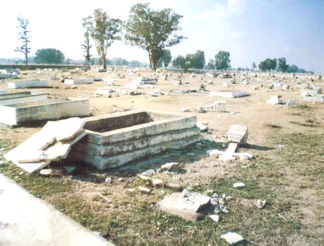
Up until the end of 19th century there used to be only muslim villages occupied by ancestors of TC's in Cyprus.Each and every one of these villages had a small or a large mosque and a cemetery...Where are they now?
Captain H.H Kitchener's Trigonometric map of Cyprus dated 1882 is an excellent evidence for the above claim.
Iceman, I am not quite sure I understand what exactly you are talking about. Can you be more specific and give us some examples of such villages, and also a link to the said map? So far I knew that a good number of mosques in Cyprus were previously Christian churches, and this is also evident by their architectural style, beside other historical accounts, but it’s the first time I hear that exclusively Muslim villages were overtaken by Greek Cypriots and their mosques destroyed.
Kifeas
During Ottoman occupation in Cyprus,there used to be villages with mix population there were also villages occupied by either only Christian population or only Muslim population..
H.H.Kitcheners map published in 1882 clearly states these villages and their population status by religion..(as well as their names use by each population)
Some of the place names Turkish administration started using after 1974 are the names which had been used for centuries..some examples are Chatal Keuy (Ayios Epiktitos) or Arap Keuy (Klepini) Ay Ghroush (Ayios Amvrosios) these villages in Kyrenia region used to have mixed population at the time the map was made but later on Turkish population and their remains vanished from these villages.
Plenty of examples i cannot remember individually now..examples of only TC villages which in time the TC population vanished and they became only GC villages with no sign of the TC's ever existing there..Like Akathu...Not many people know Akathu was a TC village..
Anyway...the H.H.Kitcheners map is not online but i have a detailed copy of it on a CD..
If interested in a copy send me a PM..
I cannot upload all of the map because its made up of loads of files (146 to be more precise) but i am uploading the index to give you an idea of what i mentioned about displaying population info as well as names used by both communities..

Thanks for the offer Iceman. I would definitely like to have a copy of Kitchener’s maps and I will contact you for this via a PM.
As for what you have mentioned above, it is a fact that at some stage during the previous century and towards the end of the Ottoman administration, Turkish or Moslem population in Cyprus were numbering as much as 25% of the total. It seems that upon British arrival in 1878, this percentage started to gradually diminish, and reached the one known for most part of 1900’s. My understanding is that as Ottoman administration and garrison left Cyprus, a number of those Turks relating to its prior existence here -as well as their families, followed suit and left back to Turkey or other Ottoman lands, since there was no longer a purpose for them in Cyprus. Furthermore, there were a number of villages that would appear as Muslims during the years of the Ottoman occupation, while they would secretly maintain their prior Christian faith -“Linobambakoi” as they were called, who would later on -as the British took over, change back to their old faith or “millet.”
Now, if Kitchener’s maps indicate Akanthou as a Turkish village, I can only assume that it is a mistake. Akanthou has never been a Turkish village –more so a purely or exclusively Turkish one. This is not only supported by numerous historical accounts, but also from the fact that the village and its vicinity have numerous (around 20) chapels and churches, some of which date back to the Middle Ages (i.e. Panayia Pergaminiotissa -11th cent., Ayia Paraskevi -18th cent.,) and some already before Kitchener’s maps (i.e. Ayios Mikallos -1864, Ayia Varvara -1870.) Furthermore, the name “Akanthou” is of Greek origin and would literally mean “thorny,” or a place where
acanthus plants grow.
It seems that Kitchener’s mistake wasn’t gone unnoticed by “authorities” in the north, who decided to fully exploit it and build their own myth, as it appears in
“Tatlisu municipality’s” website (current turkified name for Akanthou,) where it more or less repeats the same claims. It even posts a thumb shot of Akanthou from Kitchener’s map, but at the same time it does not explain to us why there is also a church marked and named (Ayia Photini) on the map, in the village’s area. The myth goes on to claim that the cemetery and the mosque were demolished to build a church and the town hall in the early 1900’s, but says nothing about the 20 or so churches and chapels, many of which were there well before the period it claims Turks were “forced out” by Greek Cypriots. It is a joke indeed!
Ayios Amvrosios was also called by Greek Cypriots as Ay(ios) Grosi(os,) which is a Greek name deriving from the name of golden colored peaches growing there, and in Greek are called “Chrisomila,” or “Grousomila” in Greek Cypriot dialect. I do not think it should be very difficult for someone to guess where the Turkish Cypriot derivative of “Ay Ghroush” comes from. Furthermore, the name they gave after 1974 is “Esentepe,” and has nothing to do with the former (pre-1974, or Kitchener’s map) name of “Ay Ghroush.”


